STEP 01
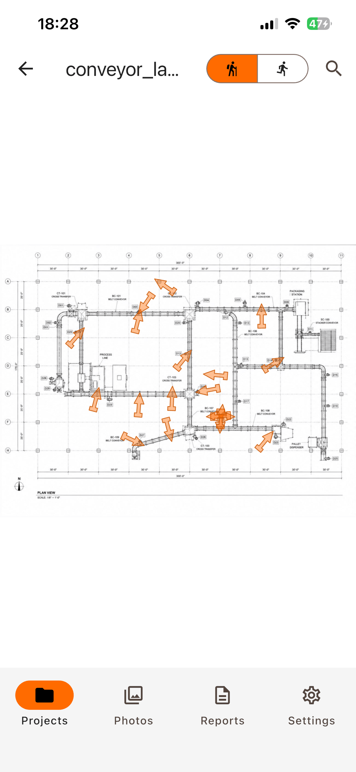
Mark where you're standing
Press the spot on the PDF drawing and drag to set which way you're facing. Position and direction, straight onto the plan.
Field documentation · iOS & Android
Fully offline. No account, no cloud, no data collected — everything stays on your device.

iPhone

Android
STEP 01
Press the spot on the PDF drawing and drag to set which way you're facing. Position and direction, straight onto the plan.
STEP 02
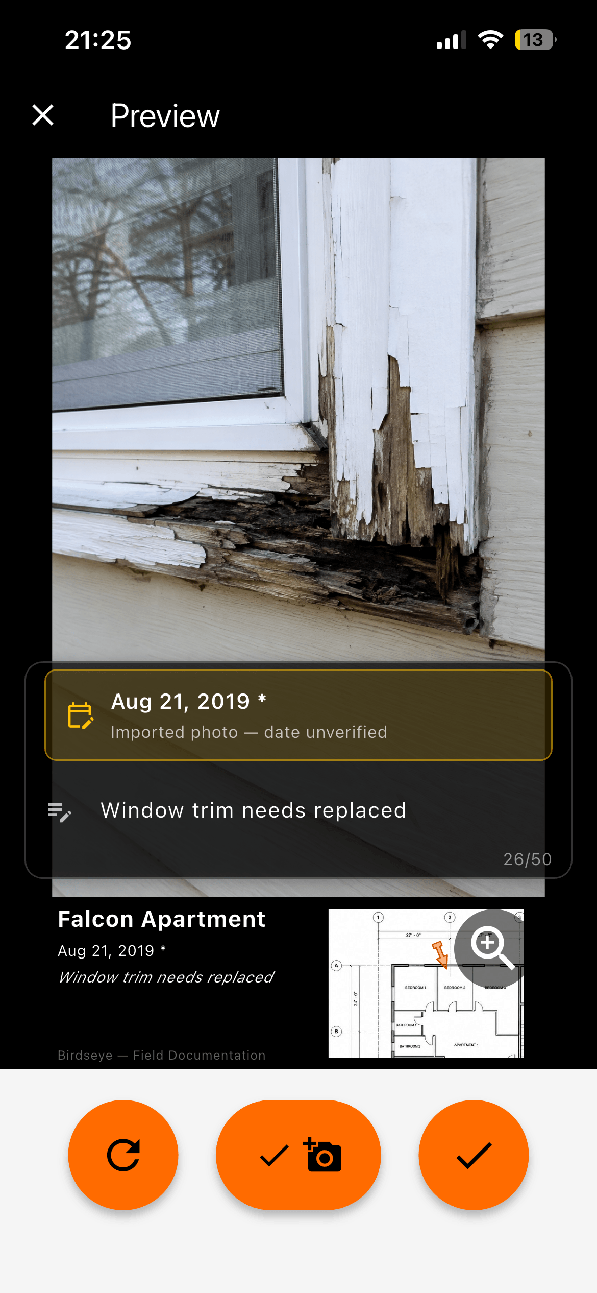
Shoot from inside the app, or pull one in from your camera roll. Each photo carries its anchor, timestamp, project, and notes.
STEP 03
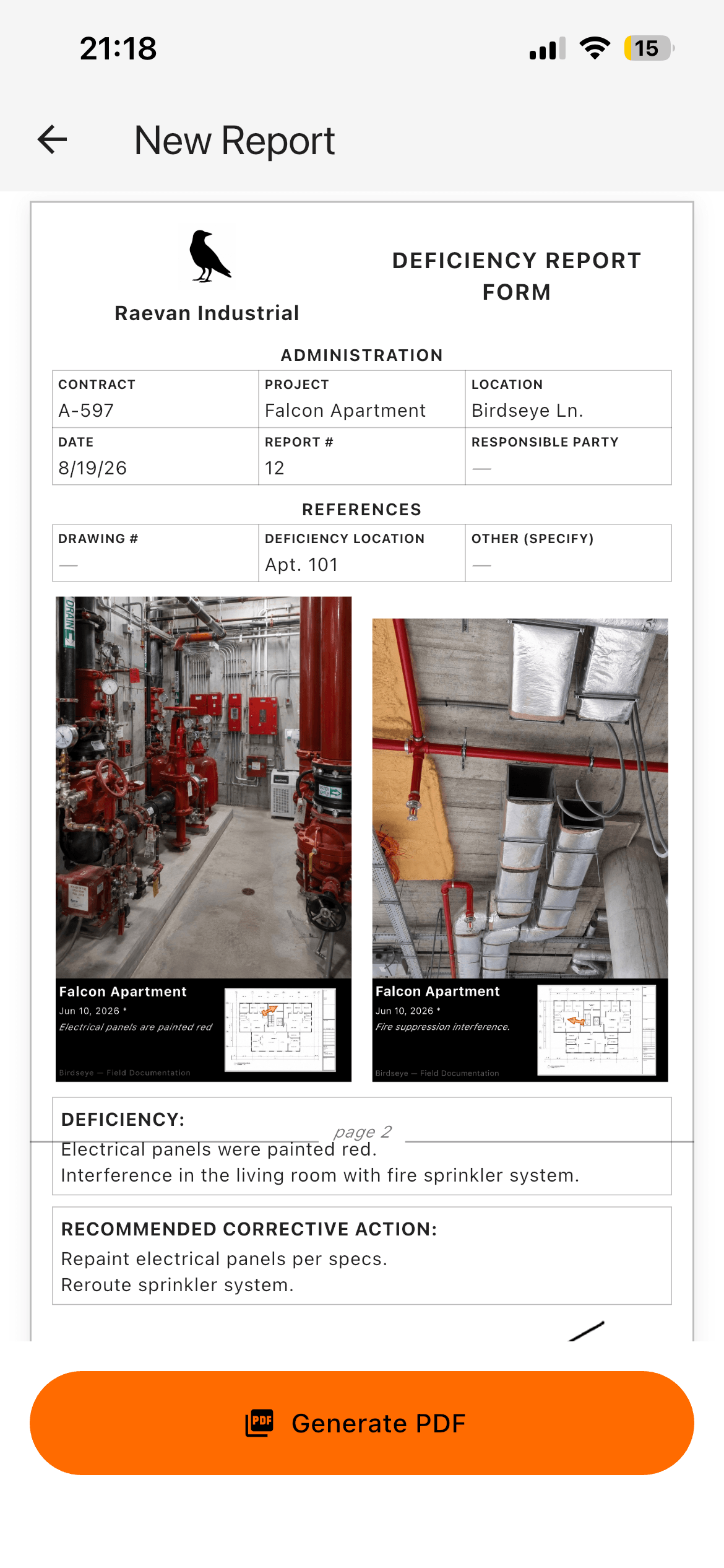
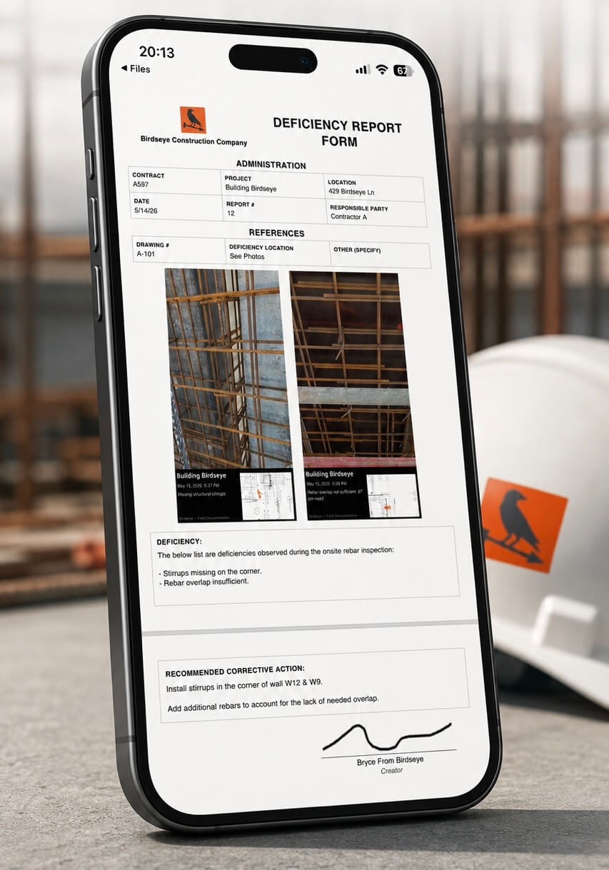
A PDF where every photo sits with its date, note, and a locator map showing exactly where on the drawing it was taken.
Your data stays yours
Birdseye has no server to send your photos to. That isn't a setting you switch on — there's nowhere for the data to go.
No sign-up, no email, no login. Install it and start documenting.
Projects, drawings, and photos live in the app's storage on your device. You decide what leaves, and when.
Position is relative to the drawing, not the earth. The app never asks for location access — which is also why it works deep inside a plant where GPS fails.
Airplane mode, dead zone, secure facility with no data allowed. Everything works the same.
In the app
Every documented photo is composed the same way on every device — phone, tablet, whichever tablet. What's on screen is what lands in the report, at full resolution, uncropped.
Photos taken inside Birdseye carry an authoritative timestamp. Photos imported from your camera roll display their best-known date and are marked as unverified, so nobody has to guess which is which months later.
Put two photos of the same location together and export the comparison — the same repair, weeks apart, with both dates and both locator maps on the page.
iPhone, iPad, Android phones and tablets, including foldables. The drawing gets the screen space; the controls move out of the way.
Who uses it
Anywhere a photo needs to be findable on a drawing six months from now.
Daily progress by area instead of by folder. When an owner asks what the third floor looked like on the 12th, you open the plan and point.
Panel schedules, rough-in, and device locations photographed against the drawing, so the next crew knows what's behind the wall before they open it.
Equipment tags, duct routing, and above-ceiling work captured where it actually sits — not guessed at from a photo of a grey ceiling.
Underground and in-wall runs documented before they're covered, with the anchor showing exactly which wall and which way you were facing.
Head locations, riser rooms, and inspection findings tied to the sheet, so the AHJ walkthrough and the report tell the same story.
Camera, reader, and drop locations pinned on the floor plan — often in buildings where a cloud app isn't going to be permitted anyway.
Build a photo record of the building you already manage. Work orders, damage, and conditions all findable by location rather than by memory.
Equipment layouts, turnaround documentation, and deep-interior work where GPS has never once helped and signal is not a given.
Punch lists and QC walks where every finding needs a location, a date, and a photo that holds up when someone disputes it.
Loss documentation with the position of every photo on the plan, and before-and-after pairs that show the same spot on two different dates.
Pricing
Birdseye installs with a sample project already loaded, so you can see the whole flow before you point it at your own drawings.
Free
$0
No account required.
Subscription
$14.99 / month
Or $149.99 a year — two months off.
Questions
It records where a jobsite photo was taken by marking the spot directly on your PDF drawing, along with which direction the camera was facing. Instead of a folder of photos nobody can place, you get photos tied to locations on the plan, and a PDF report that shows both.
Yes. Birdseye is offline by design — there is no server, no account, and no sync. It behaves identically in airplane mode, in a basement, or inside a facility that doesn't allow outside connections.
No. Birdseye never requests location permission and captures no real-world coordinates. A photo's position is relative to the drawing you loaded, which is why it works in interiors where GPS is unreliable or unavailable.
On your device, in the app's own storage. Nothing is uploaded anywhere. You choose what leaves the device by exporting a report or sharing individual photos.
Any PDF — floor plans, site plans, equipment layouts, as-builts, single sheets or multi-page sets. Load the file you already have; there's nothing to convert first. If you are in a pinch, draw it on a napkin and convert it to a pdf, that works too.
A PDF with each photo shown at full resolution alongside its date, project details, any notes, and a small locator map of the drawing showing where the photo was taken.
Yes — iPad, Android tablets, and foldables, in portrait or landscape. The layout adapts so the drawing keeps the screen space.
Construction supervision, inspection, facilities and industrial maintenance, punch lists, as-built documentation, and anyone who takes jobsite photos that somebody will need to locate later.
Not yet. A read-only viewer for sharing whole projects is the next thing planned, followed by a desktop editor for back-filling older jobs.
The free tier covers up to 2 projects, so you can run a real job through it before deciding. The subscription is $14.99 a month or $149.99 a year and removes the caps. There's no account to create either way.
Point your phone camera at a code
Click anywhere to close